Survey: How are you getting around in Asbury Park, and in Monmouth County?

Have you seen or encountered obstacles to getting around in Asbury Park, or in your city in Monmouth County?

The Monmouth County Division of Planning, Transportation and Community Services hosted an open house on Thursday, Nov. 16 asking for feedback to improve mobility throughout Monmouth County.

An interactive mapping tool that let’s you easily pick and comment on places that need imorovement: It only takes a few minutes to do it!

This open house was the first public event for Monmouth Paths Access For All, a transportation study that will evaluate existing barriers to mobility and recommend strategies to achieve equitable mobility,

We look forward to seeing the results and next steps to improving access for everyone to get around our county and Asbury Park!

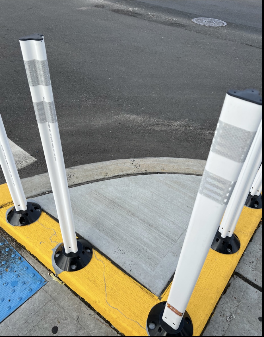
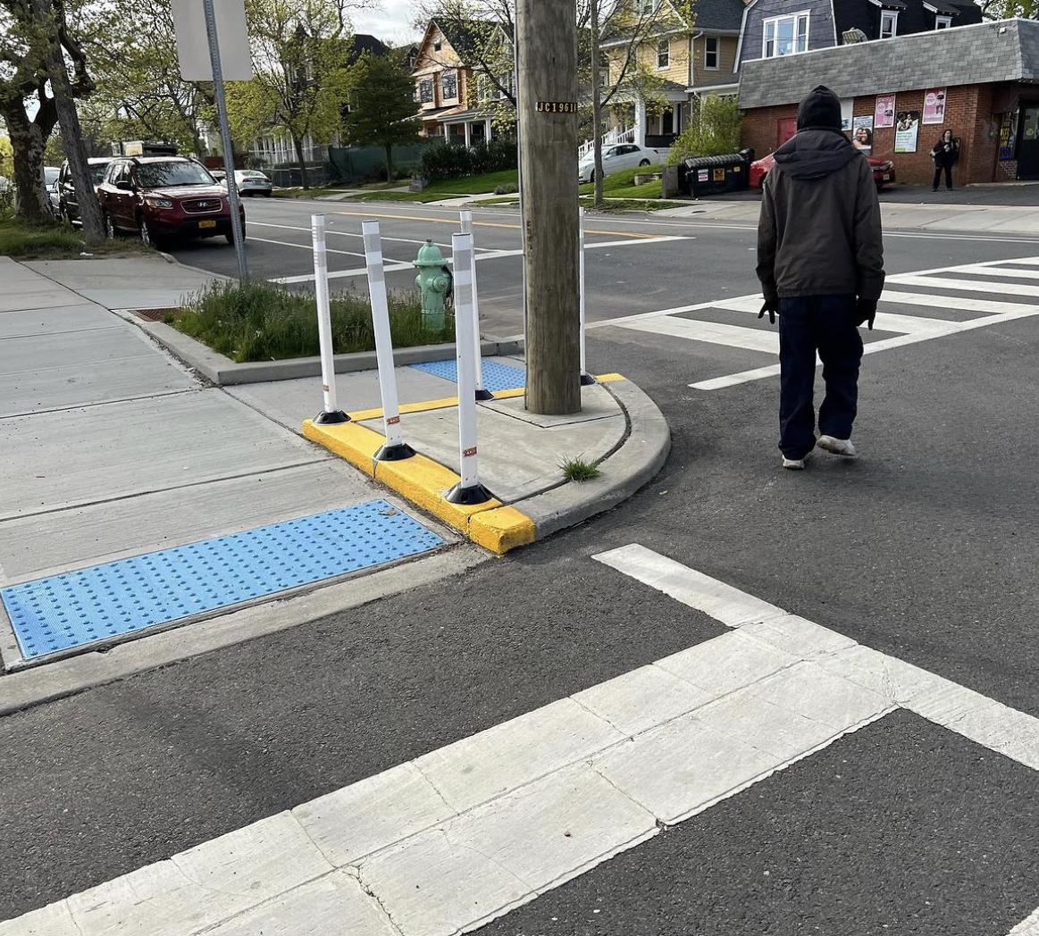
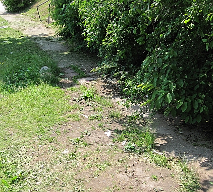
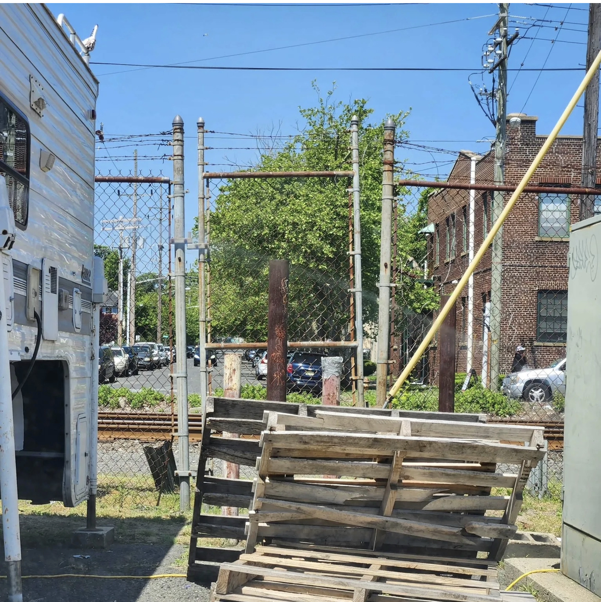
Here are some obstacles we’ve experienced in Asbury Park:


#NJDOTengineering: 4 intersections in Asbury Park’s Main St. include raised concrete corner wedges for zero purpose. Trip hazards, so they painted the edges yellow. Still trip hazards, so they came back again and glued on plastic flex posts, which have almost all fallen off. Can these meaningless chunks of concrete be removed?
No purpose for these weird blocky corners. Notice here, one flex post is gone. That was months ago. Now ALL of them have fallen off.
If you’re a bike rider, what does it mean when you see a sign like this “bike lane ends”? What does it mean to drivers? Whose interest is being served with this kind of signage?
If you drive around the Asbury/Neptune circle heading north and west, you might never notice this overgrown sidewalk. If you have to walk along that sidewalk, it’s dangerous, disappearing under encroaching weeds, and unlit, dangerous at night.
If you’re a person on a bike coming off the Ocean Grove bridge toward Lake Ave you’ll see that the concrete path does not lead to the ramp to the street, so people on bikes have created a “desire path” to get to the ramp, although a dirt path isn’t the safest place to ride a bike.. How could the city improve this situation? Moving the ramp could be a good solution.
NJDOT/NJTransit One of 2 closed railroad crossings in Asbury Park. It has eliminated a access for people who live in that neighborhood to get home, or to destinations in the city, and collected debris and trash.
NJDOT Confusing instructions on Main St. in Asbury Park for pedestrians to cross the street, especially for non-Engllsh speakers. Our streets should not prioritize drivers above other road users.
No curb ramps on 5th Ave in Asbury Park to roll a wagon with kids, or a stroller, or for anyone with a handicap.

We need your help to understand the mobility challenges you encounter (or that you observe) when travelling to work, school, healthcare appointments, shopping, or whenever you’re walking or rolling in Monmouth County.

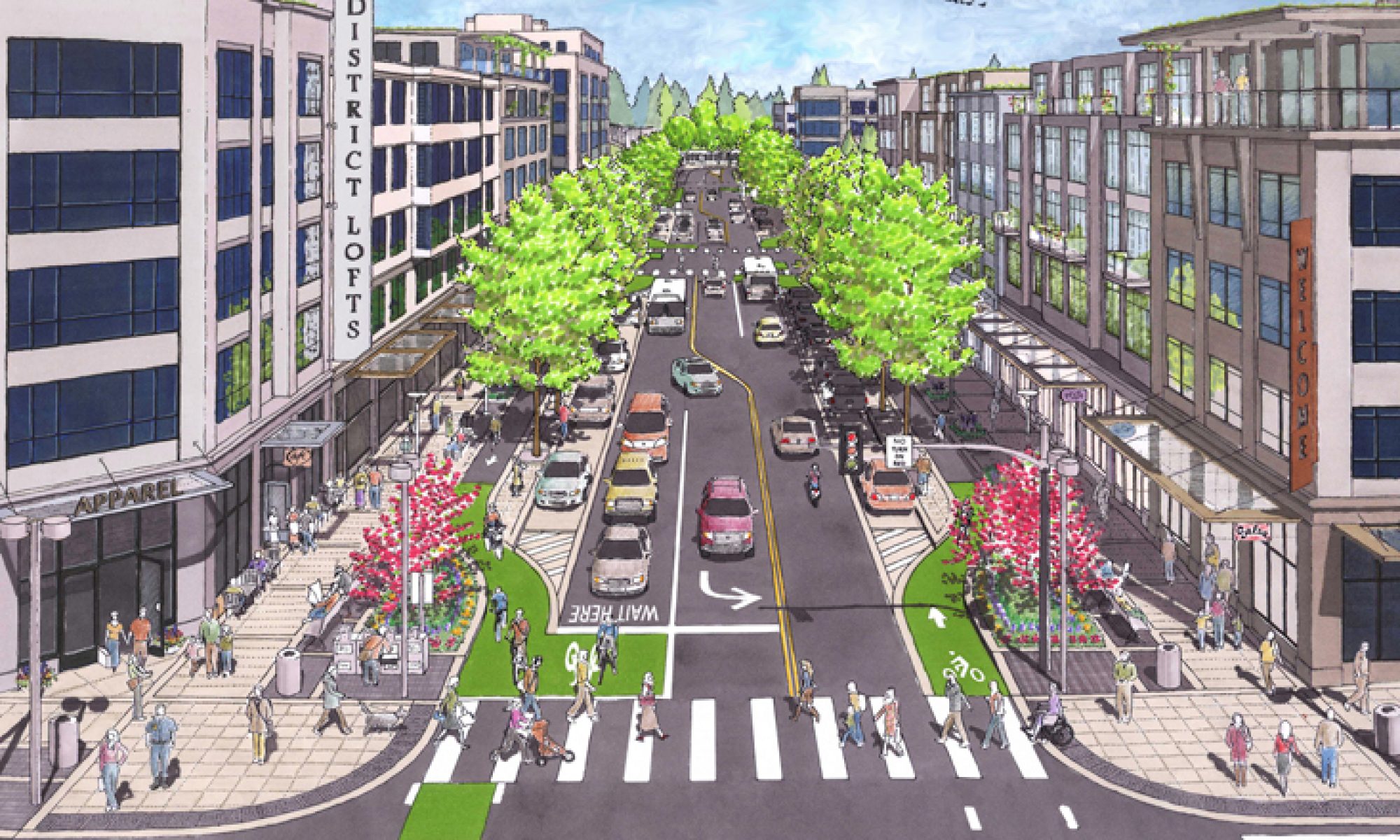
Whether you drive, take public transportation, walk, bike, or use another mode of transportation, you might notice or encounter mobility barriers, such as in these photos, or traffic congestion, unsafe intersections, infrequent bus service, no bus shelters, missing sidewalks or ADA curb ramps, no bike parking, etc.

It’s easy!  Use the online mapping tool to identify and comment on places with mobility obstacles in Monmouth County that you’ve noticed, or experienced yourself.

The information you provide will be vital to informing the Monmouth Path Study, a transportation planning study that will identify and develop measures to reduce or eliminate mobility barriers for Monmouth County residents.

The goal of this study is to provide guidance for the County and its municipalities to reduce or overcome existing barriers and prevent new obstacles. This will be accomplished by combining data analysis and the lived experiences of County residents to evaluate infrastructure, policy, socioeconomic, and awareness factors that can be major limitations for the traveling public. Potential outcomes of this study include strategies to improve the built environment in a variety of land-use areas within the County.

Onward~

Polli Schildge

Editor, APCSC

The 99% Invisible Built Environment Around Us

For most of my life I paid almost no attention to the design of the built environment around me. As a person walking, riding a bike, and driving, plus teaching 6 children to navigate their neighborhood on foot, on bikes, and cars, I moved about in my world – using streets and sidewalks without taking much notice of the actual design of crosswalks, or striping of lanes.

This changed dramatically when I became involved in the issue of a road reconfiguration in Asbury Park. Suddenly, clarity! I began to notice every detail of the design of the city, and the ways that people utilize the infrastructure that exists around them. What had been invisible to me is probably invisible to most people who move through their days to school, work, recreation…and it’s been planned to function that way.  I began to notice how much of my (any) city, or suburb is devoted to the level of service for motor vehicles, and street storage (aka parking). I researched city and suburban planning and design, and learned that automotive industry titans were the major players in the early 20th century in get everyone into cars, and the rest is history. Over the course of time we’ve been conditioned to use, but not to notice design around us.

Recommended listening: 99% Invisible Podcast, and the following article about the new book, The 99 Percent Invisible City: a Field Guide to the Hidden World of Everyday Design, reveals the secret history of urban errata around the world and on your own block.

‘A City is a Series of Choices Over Time’: Roman Mars Reveals the Secret Histories That Shape Our Streets

For over 10 years, the “99 Percent Invisible” podcast has been a touchstone for anyone interested in the often-overlooked design choices that shape our world — and particularly, the auto-centric design choices that shape our streets. More than 400 million downloads later, host Roman Mars collaborated with producer Kurt Kohlstedt to co-author The 99 Percent Invisible City: a Field Guide to the Hidden World of Everyday Design, which reveals the secret history of urban errata around the world and on your own block.

From the surprising insights that gave the jersey barrier its curves to the bizarre crash that lead to the invention of the roadway centerline, the stories in its pages inspire us to give the everyday a second look — and realize how profoundly our streets can be remade by simple design choices, no matter the violent history that may have built them.

We talked with Mars about his new book, and why wonder might be the missing ingredient in the fight to end traffic violence.

From the interview:

“I think it all comes from the relatively recent concept that streets are for cars, so there’s no reason to look at them any closer. And of course, that’s a relatively recent narrative, and it was consciously created by the powerful voices of motordom. For centuries, our streets were a truly multimodal and multipurpose space: they had pedestrians and trolleycars and horses and vendors and all these things, until we ceded that territory a hundred years ago to the automobile. We’re just now starting to figure out what we lost when we made that shift, and how to get it back.

What I’d most like people to do with the book is recognize that a city is a series of choices over time, and there is nothing inherent in a street that says that a car belongs on a road and a pedestrian only belongs on a sidewalk — or maybe at crosswalk, but only when the light changes. It wasn’t always that way, and we can modify it to be however we want it to be.”

Read more:

https://usa.streetsblog.org/2020/12/11/a-city-is-a-series-of-choices-over-time-roman-mars-reveals-the-secret-histories-that-shape-our-streets/


What is Tactical Urbanism? An International Movement

“Cities around the world are using flexible and short-term projects to advance long-term goals related to street safety, public space, and more.”

APCSC and other Complete Streets advocates believe that streets are for people. We know that even with best intentions cities sometimes miss opportunities, or are financially challenged to effect changes away from car-centric streets.  We can get creative to make streets into places for people: for health, for social well-being, for the environment, and for economic benefit.

Tactical Urbanism is all about action. Also known as DIY Urbanism, Planning-by-Doing, Urban Acupuncture, or Urban Prototyping, this approach refers to a city, organizational, and/or citizen-led approach to neighborhood building using short-term, low-cost, and scalable interventions to catalyze long-term change.

Learn about it:

http://tacticalurbanismguide.com/

What Does Vision Zero Mean?

Learn about Vision Zero from Jerry Foster of Greater Mercer TMA in an article discussing the meaning of VZ as it relates to safer streets in Princeton and in NJ. Aren’t streets and roads designed for safety…or are they primarily designed to expedite cars?

Vision Zero: A Comprehensive Re-Thinking of Road Safety

At the local level some safety advocates have recognized the urgency of the situation (National Transportation Safety Board (NTSB) study showing an increase in pedestrian deaths), and are taking up the cause. Below, Jerry Foster of the West Windsor Bicycle & Pedestrian Alliance outlines Vision Zero, a safety plan that has been effective in other countries that activists are trying to bring to New Jersey.

What Is Vision Zero?

It’s not just another blame-the-victim (and enforcement) safety campaign! Vision Zero is a comprehensive re-thinking of road safety that brings everyone to the table to systematically prevent crashes and reduce crash severity — just like airline and railroad crashes.

Read more…

https://princetoninfo.com/vision-zero-a-comprehensive-re-thinking-of-road-safety/